Access · Trail Guides
Access · Trail Guides
Access
The Takase Dam can be accessed from Takayama, Matsumoto and Tokyo, Nagoya, Osaka and Toyama by use of nonstop buses.
-
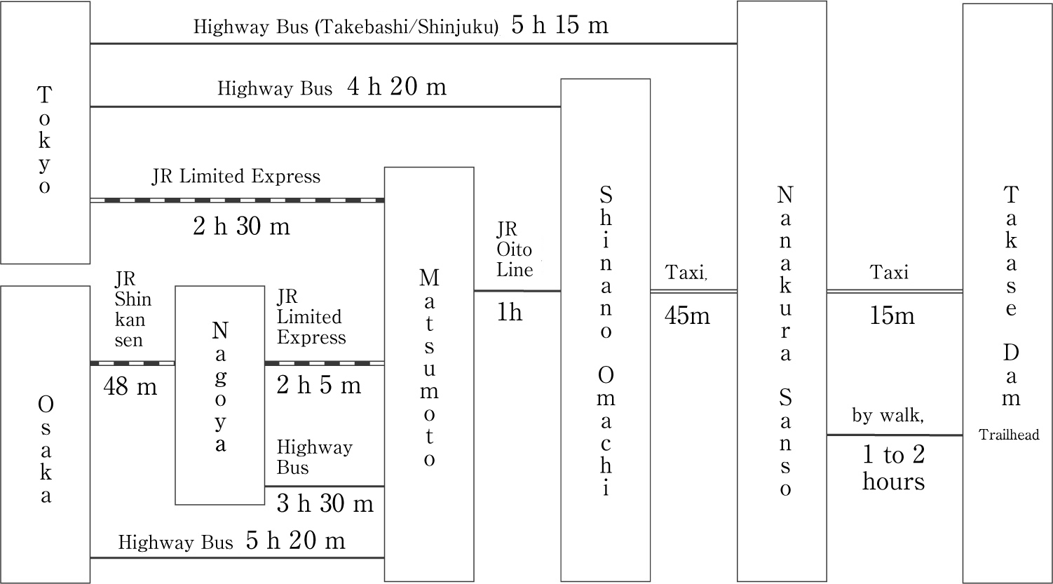
By TRAIN From JR Shinano-Omachi Station, take taxi to Nanakura Sanso There is shared taxi. Shinano-Omachi to Nanakura Sanso Shinano-Omachi Navi HP -
BY TAXI From Shinano-Omachi to Nanakura Sanso 45 minutes, Fare 8,400 per carFrom Nanakura Sanso to Takase Dam 15 minutes, Fare 2,200 yen per car*Up to four passengers per car can be accommodated. *Because the road between Nanakura Sanso and Takase Dam is the maintenance road of Tokyo Power Electric Co., one needs to switch to the taxi with permit.Because the road between Nanakura Sanso and Takase Dam is the maintenance road of Tokyo Power Electric Co., one needs to switch to the taxi with permit. Information on Taxi Omachi City, Nagano Prefecture Tourist Bureau Official HP -
Highway Bus from Major Cities There are highway buses to JR Shinano-Omachi Station from Tokyo, to JR Matsumoto Station from Osaka and Nagoya. General way is to switch to taxi from JR Shinano-Omachi Station. For reference, click details of nonstop buses from Tokyo to Nanakura Sanso Maitabi Trekking Bus, Mainichi Alpen-Go HP Reference Information: Nonstop Bus from Tokyo to JR Shinano-Omachi Station (from JR Shinano-Omachi Station to Nanakura Sanso, use taxi) ALPICO Group (Highway Bus) Shinjuku
Azumino/Omachi/Hakuba HP -
By CAR There is Municipal Parking in front of Nanakura Sanso*In a peak season such as the successive holidays, those parking lots become full, so if you plan to come in such time, please consider using public transportations.
(FREE, 50 cars)
Trail Guides
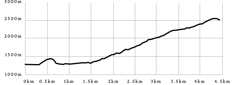
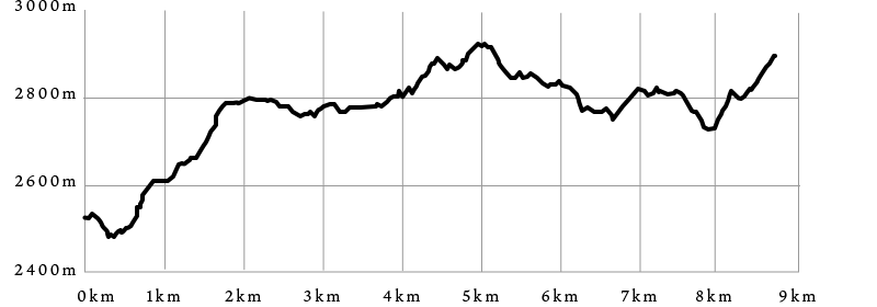
Takase Dam - Kumonodaira Mountain Hut
Accessed by use of taxi from JR Shinano-Oomachi Station to Nanakura Sanso or Takase Dam
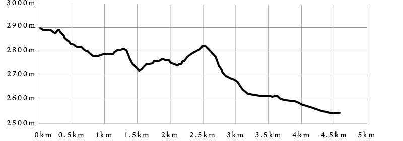
This route requires 3 days for one way totaling 15 hours and 5 minutes.
This route requires 3 days for one way totaling 15 hours and 5 minutes.
Approximate Trekking Time
-
Day 16 hours 10 minutes(excluding break time)Takase Dam - 0:40 - Bunatate Ridge Trailhead - 4:00 - Sankakuten(Triangulation Point) - 1:30 - Eboshi Hut
-
Day 26 hours(excluding break time)Eboshi Hut - 1:30 - North Peak of Mt. Mitsudake - 1:40 - Noguchigoro Hut - 0:50 - Takemura Shindo Trail Junction - 1:00 - Higashizawa-Nokkoshi Pass - 1:00 -Suisho Hut
-
Day 32 hours 55 minutes(excluding break time)Suisho Hut - 0:45 - Warimo Kita Junction - 0:10 - Iwagoke Nokkoshi Passt - 0:40 - Mt. Ji-Dake - 0:30 - Mt. Ji-Dake Junction - 0:30 - Kumonodaira Camp Site Junction - 0:20 - Kumonodaira Mountain Hut
for Smartphone/Tablet


