- Nature of Kumonodaira Vol.1 -
How Kumonodaira Was Formed
Written by Satoru Harayama, Composed by Tomohiko Yoshida, Illustrations by Takashi Matsumoto
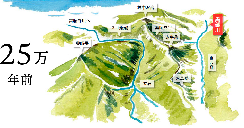
The Kumonodaira Plateau has a surprisingly gentle terrain despite being located at the center of the Northern Japan Alps where rows of precipitous peaks stretch. Professor Satoru Harayama, aka Detective of Geology, will solve this mystery. Kumonodaira, located at the remotest region in the Northern Japan Alps, is filled with mysteries. Firstly, Kurobe River that is flowing around the terrace-like shape of Kumonodaira is mysterious. Flow of its riverhead starts from Mt. Warimo-Dake and the Iwagoke-Nokkoshi Col, then changes its direction to south, west, north and east. After passing the Yakushizawa Creek Junction and the Daito-Shindo Trail Junction, the river finally changes its course northward and flows towards the direction of Tateishi. There is no river basin besides the Kurobe River Basin that busily changes direction of its flow. It is contrary to the neighboring Higashizawa Ravine that flows straight northward.
Next mystery is the existence of thick sand gravel layer (gravels) that exposes itself at the trail leading to Kumonodaira and Creeks A, B, C, D along the Daito-Shindo Trail. Though in the alpine region, gravels should be carried away by streams little by little, and the fact that the sand gravel layer with thickness of nearly 200 meters has accumulated is no ordinary matter. Something extremely unusual must has happened.
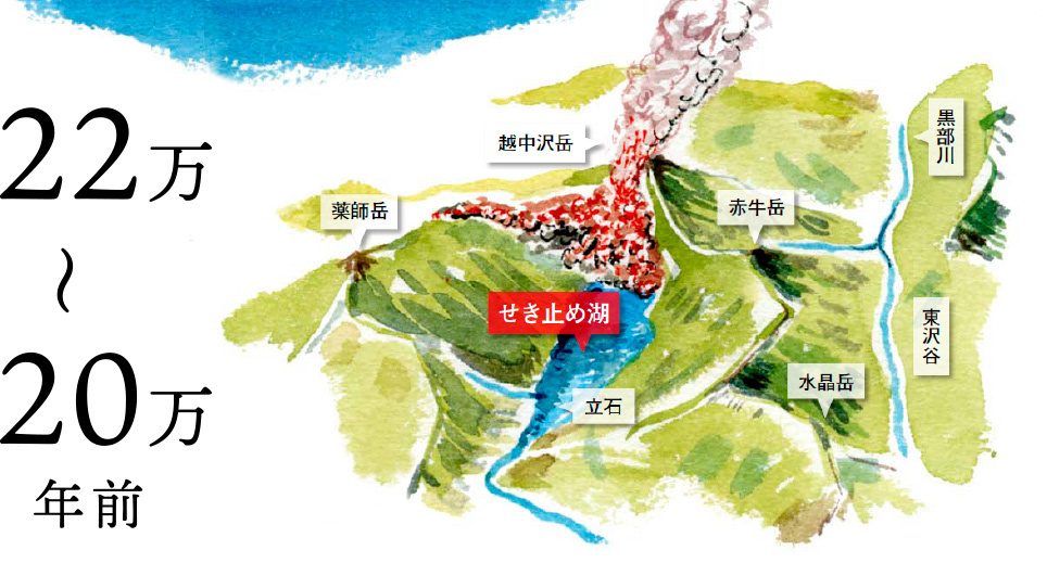
And there are molten rocks that cover the plateau. Having Mt. Jii-Dake and Kumonodaira as the center, molten rocks that are nearly 300 meters thick lap over the sand gravel layer, and the Kurobe River flows around the plateau as if the river avoids it. This structure resembles the structure of a decorated cake. The sponge portion is the sand gravel layer and fresh cream covering the sponge is the molten rocks.
Since then, details of age and deposition of the molten rocks came to light thanks to another research. In the lower part of the sand gravel layer, volcanic ash aging from 300,000 to 400,000 years old, that flowed from the direction of Mt. Momisawa-Dake, was discovered and it was revealed that 10 to 25 meters thick molten rocks were sandwiched between the sand gravel layer just around in altitude of 2,100 meters. This sandwiched portion of the molten rocks were 310,000 years old and erupted from the vicinity of Mt. Warimo-Dake. The age of the molten rocks of Mt. Jii-Dake was 160,000 years old, that of Kumonodaira was 100,000 years old, and both erupted from the area of Mt. Jii-Dake.
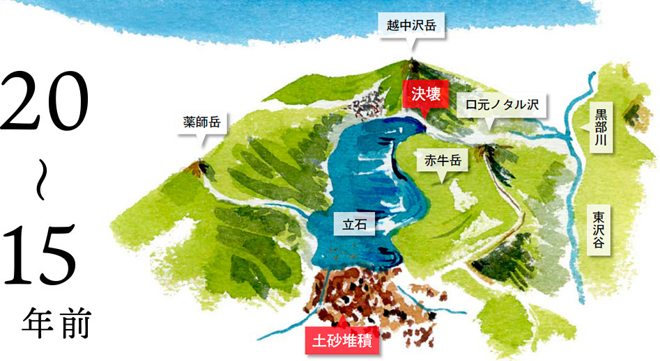
For thick sand gravel layer, its origin was divided into two different periods, Old and New with sandwiched molten rocks in its border. One for Old Period is 300,000 to 400,000 years old, the other for New Period is 100,000 to 220,000 years old and both layers accumulated in the old ravine that stretched in the direction of Oku-no-Rouka and Tateishi while passing from the Jii-Zawa Creek Junction through the area below the Kumonodaira Plateau. Thus, search began on hypothesis that the event that caused accumulation of thick sand gravels might have happened further downstream. A series of investigation followed. The Takamagahara-Shindo Trail Investigation in August 1986, the Upstreaming the Kaminorouka Ravine Investigation in September 1987, the Nakanotaru-Sawa and the Sugo-Sawa Creeks Investigation in August 1988, the Sugodani Ravine Investigation in August 1989, and the truth came to light.